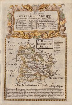
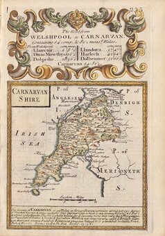
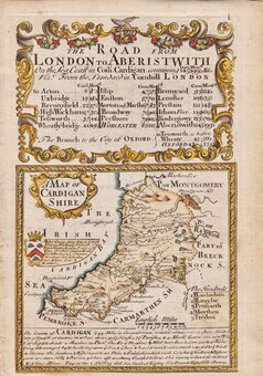
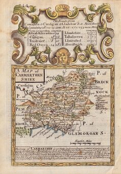
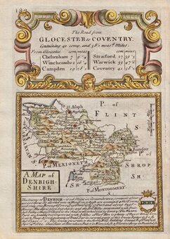
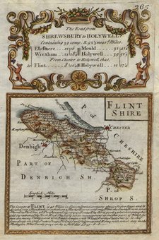
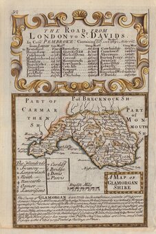
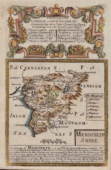
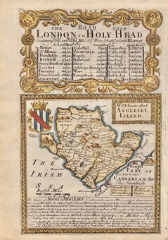
Welsh Counties

Maps of the old Welsh Counties.
Anglesey
View Category
Anglesey 7 maps

Maps of the Isle of Anglesey / Ynys Mon

Brecknockshire
View Category
Brecknockshire 8 maps

Maps of Brecknock, today part of Powys.

Caernarfonshire
View Category
Caernarfonshire 8 maps

Maps of Caernarfon today part of Snowdonia / Gwynedd

Cardiganshire
View Category
Cardiganshire 5 maps

Maps of Cardigan / Ceredigion

Carmarthenshire
View Category
Carmarthenshire 6 maps

Maps of Carmarthenshire / Sir Gaerfyrddin

Denbighshire
View Category
Denbighshire 7 maps

Maps of Denbighshire and Wrexham / Sir DDinbych & Wrecsam

Flintshire
View Category
Flintshire 7 maps

Maps of Flint or Flintshire / Sir y Fflint.

Glamorganshire
View Category
Glamorganshire 5 maps

Antique Maps of Glamorgan today including Swansea, Neath Port Talbot, Bridgend, Vale of Glamorgan, Rhondda, Merthyr Tydfil, Caerphilly, Cardiff, Blaenau Gwent / Abertawe, Castell-Nedd Port Talbot, Pen-Y-Bont Ar Ogwr, Bro Morgannwg, Cynon Taf, Merthyr Tudful, Caerffili, Caerdydd, Blaenau Gwent.

Merionethshire
View Category
Merionethshire 6 maps

Maps of Merioneth today part of Snowdonia / Gwynedd

Monmouthshire
View Category
Monmouthshire 19 maps

Maps of Monmouth now including Torfaen and Newport Tor/Faen and Casnewydd.

Montgomeryshire
View Category
Montgomeryshire 5 maps

Maps of Montgomery, today part of Powys.

Pembrokeshire
View Category
Pembrokeshire 5 maps

Maps of Pembroke or Pembrokeshire / Sir Benfro

Radnorshire
View Category
Radnorshire 8 maps

Maps of Radnor, today part of Powys.