
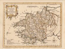
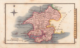
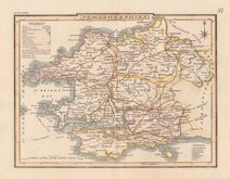
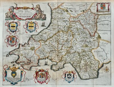
South Wales
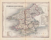
Pembrokeshire
( Page 1 of 1 )


12x18 cm
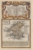
PEMBROKE SHIRE
Map set below a decorative title cartouche containing the title and details of the road from St. Davids to Holywell.
Engraved description of the county below the map.
Road map showing the start of the route from St. Davids to Cardigan verso.
Engraved by Emanuel Bowen (1693?-1767) and published in the pocket road book Britannia Depicta by Thomas Bowles from 1720 to 1764. The county maps were based on Robert Morden's small series published in The New Description and State of England... from 1701.
Very good example in neat later hand colour.
Quick Links
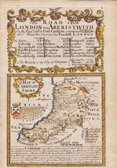
Cardiganshire
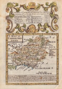
Carmarthenshire
×