

British Isles
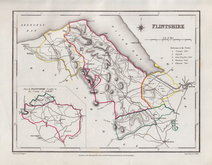
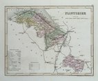
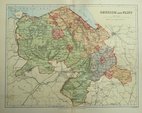
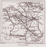
Flintshire
( Page 1 of 1 )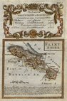
Emanuel Bowen 1720
Cole & Roper 1810
Sidney Hall 1820
Roger Creighton 1844
Archer, Joshua 1860
Weller, F. S. 1891
Geographia 1924


12x18 cm
(MAP TITLE)
Map set below a decorative cartouche containing the title and details of the road from Shrewsbury to Holywell
Road map of the first part of the route verso.
Engraved by Emanuel Bowen (1693?-1767) and published in the pocket road book Britannia Depicta by Thomas Bowles from 1720 to 1764. The county maps were based on Robert Morden's small series published in The New Description and State of England... from 1701. Text descriptions compiled by John Owen.
For full description of the road, go to the listing under category: RoadMaps > Owen & Bowen.
For more information on Britannia Depicta, see the description in the category heading under Road Maps > Owen & Bowen.
Slight water damage to paper edge at the top but engraved area is not affected. Neat later hand colour.

×