
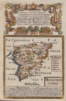
Merionethshire
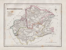
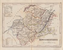
Montgomeryshire
( Page 1 of 1 )


12x18 cm
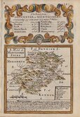
A MAP of MONTGOMRY SHIRE
Map set below the title and details for the road from Gloucester to Montgomery.
Engraved description of the county below the map.
Road map showing the first part of the road from Gloucester to Montgomery as far as Hereford verso.
Engraved by Emanuel Bowen (1693?-1767) and published in the pocket road book Britannia Depicta by Thomas Bowles from 1720 to 1764. The county maps were based on Robert Morden's small series published in The New Description and State of England... from 1701.
A very good example in neat later hand colour.
For full description of the road, go to category 'Owen & Bowen' under 'Road Maps'.
For information on the publication Britannia Depicta see the description below the category heading 'Owen & Bowen'.
Quick Links
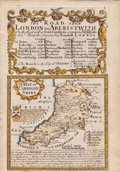
Cardiganshire
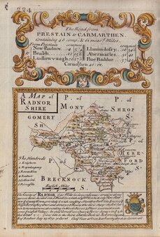
Radnorshire
×