
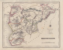
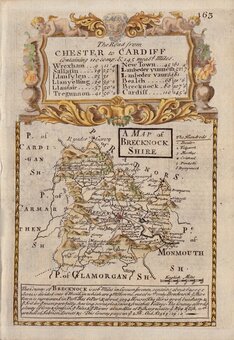
Brecknockshire
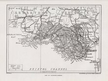
Glamorganshire
( Page 1 of 1 )


12 x 18 cm
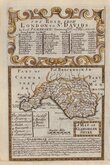
A MAP OF GLAMORGAN SHIRE
Map set below the decorative title to the road from London to St. Davids.
Road map showing Bromsgrove to Bridgenorth and Banbury to Chipping Camden verso.
Engraved by Emanuel Bowen (1693?-1767) and published in the pocket raod book Britannia Depicta by Thomas Bowles from 1720 to 1764.
Good example with fine later hand colour both sides. Bottom edeg has been remargined in matching paper where the map border is printed close to the paper edge.
Quick Links
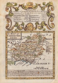
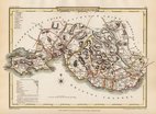
Carmarthenshire
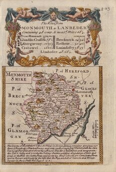
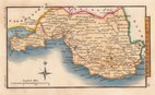
Monmouthshire
×