
Road Maps
Regional Maps
( Page 5 of 10 )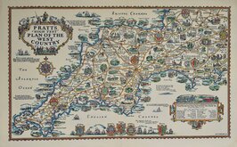
Alfred Taylor Pratts West Country 1932
Alfred Taylor Pratts Plan of the North 1932
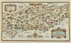
Alfred Taylor Pratts South Coast 1932
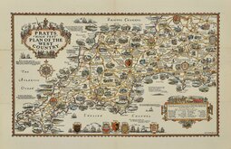
Alfred Taylor Pratts West Country 1932
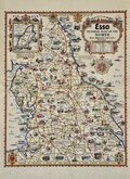
Alfred Taylor Esso Plan of the North 1936
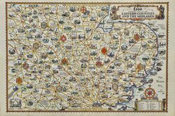
Alfred Taylor Esso Eastern Counties 1936
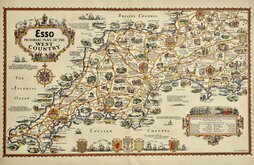
Alfred Taylor Esso West Country 1936
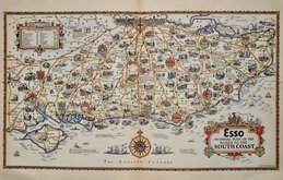
Alfred Taylor Esso South Coast 1936

£185 Alfred Taylor Pratts West Country
Ref: 4037gb
Add to
basket
Thanks,Your Product Has Been Added To Basket

70x43 cm
PRATTS HIGH TEST PLAN OF THE WEST COUNTRY
A·E·TAYLOR·32
Pictorial colour printed map drawn by Alfred Edward Taylor (1887-1895) issued by Pratt's Motor Oil Company as promotional advertising. Description of the main places on the map by S.P.B. Mais - Stuart Petre Brodie Mais (1885-1975) verso.
Describing the maps, S.P.B. Mais writes, "I have seldom, if ever, seen a happier blending of the artist and wit in a cartographer. They are jolly, they are informative, they are original, and they have a magic enticing quality about them..."
A very good clean example on heavy paper with a single centrefold only.
Quick Links


Folding Maps
Town Plans
×