
Rutland Maps
Lincolnshire Maps
( Page 1 of 3 )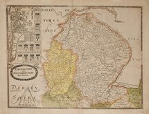
Christopher Saxton 1579 [1693]
Richard Blome 1673
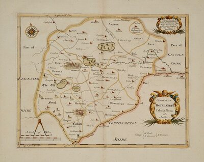
Robert Morden 1695
Emanuel Bowen 1720
Thomas Read 1744 [1769]
Thomas Kitchin 1763
Joseph Ellis 1765 [1773]
Nathaniel Coltman 1806 [1809]


28x33 cm
FINE EXAMPLE
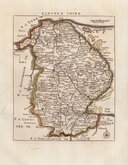
A MAPP of ye COUNTY OF LINCOLNE. Wth its Divisions, & Hundreds : or Wapontacks : by Ric : Blome.
Produced and published by Richard Blome (1635-1705), Bookseller, mapseller amd publisher, Printer to King William III and Cosmographer to Queen Anne. This series of maps were produced quickly following an announcement in the press by John Ogilby of his intention to produce a new work of county maps, road maps and town plans entitled Britannia. Blomes maps are crudely engraved, typical of journeyman work, and mostly copied from those of John Speed. The printing, however was of the highest standard, being carried out by Thomas Roycroft, printer to King Charles II. Richard Blome shamelessly used the same title announced by John Ogilby for his work, commencing publication in 1673.
The edition was probably on sale for four years. There was a re-issue of 1677 made up by John Wright from remaindered sheets.
Fine example in neat hand colour.
Ref. Carroll Printed Maps of Lincolnshire 14(i)
SPECIAL OFFER MOUNT OPTION AVAILABLE ON THIS ITEM AT CHECKOUT FOR UK DELIVERY.
Quick Links

Cambridgeshire Maps

Nottinghamshire Maps
×