
Nottinghamshire Maps
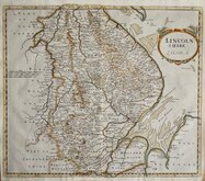
Lincolnshire Maps
( Page 1 of 3 )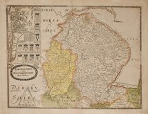
Christopher Saxton 1579 [1693]
Richard Blome 1673
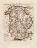
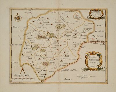
Robert Morden 1695
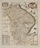
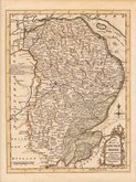
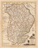
Emanuel Bowen 1720
Thomas Read 1744 [1769]
Thomas Kitchin 1763
Joseph Ellis 1765 [1773]
Nathaniel Coltman 1806 [1809]


12x18 cm
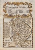
FROM "OWEN & BOWEN" POCKET ROAD BOOK BRITANNIA DEPICTA
A MAP of LINCOLN SHIRE.
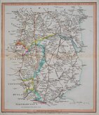
Map set below a decorative cartouche containing the title and details of the road from Nottingham to Grimsby.
Road map of the second part of the route from Monmouth to Llanybydder verso.
Engraved text descriptions below the county map and alongside and below the road map.
Engraved by Emanuel Bowen (1693?-1767) and published in the pocket road book Britannia Depicta by Thomas Bowles from 1720 to 1764. The county maps were based on Robert Morden's small series published in The New Description and State of England... from 1701. Text descriptions compiled by John Owen.
Light water damage to top edge of paper. Strong impression, fine hand colour.
For full description of the road, go to category: Maps > British Isles > RoadMaps > Owen & Bowen. For more information on Britannia Depicta, see the category heading under Road Maps > Owen & Bowen.
Ref. Carroll Printed Maps of Lincolnshire. 23(i).
Quick Links


Cambridgeshire Maps
Rutland Maps
×