
Derbyshire Maps
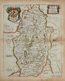
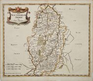
Nottinghamshire Maps
( Page 1 of 4 )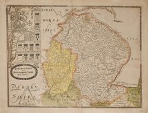
Christopher Saxton 1579 [1693]
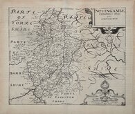
William Kip 1607
William Kip 1607 [1610]
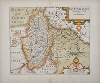
Jan Jansson 1646
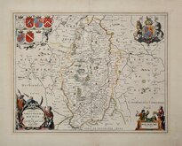
Richard Blome 1673
Robert Morden 1695
Emanuel Bowen 1720
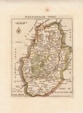
Thomas Read 1744 [1769]


40x53 cm
SAXTON LEA. NO CENTREFOLD. ORIGINAL COLOUR. RARE.
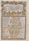
LINCOLNE SHIRE AND NOTTINGHAME SHIRE By C SAXTON
Christophorus Saxton desripsit.
Remigius hogenbergius sculpsit
Christopher Saxton (1542?-1610?), Yorkshire born surveyor and mapmaker, produced the first English Atlas of the English and Welsh counties, between 1584 and 1579, first published in an atlas without title page in 1579.
Saxton was brought at Dunningly, near Wakefield and attended Cambridge University. He worked as a surveyor under John Rudd, vicar of Dewsbury and probably used some of Rudd's survey material to compile his atlas. He obtained a patronage from Queen Elizabeth and Thomas Seckford, Master of the Queen's Requests, and was granted a royal privilege for publishing his maps in 1577. He died about 1610 or 1611 and is thought to be buried at Woodkirk, near Wakefield.
Seven engravers were employed, probably by Thomas Seckford, to engrave the maps and Christopher Saxton himself may have engraved the Welsh counties and Herefordshire.
The map of Lincolnshire and Nottingham was engraved by Remigius Hogenburg (1536-1588), a Flemish emigrant working in England. The maps were re-published in 1645 by William Web, and in 1689 and 1693 by Philip Lea. Many of the plates continued to be published with revisions into the late 18th century by various publishers.
This example, with a number of changes to the plate, was issued by Philip Lea in his Shires of England and Wales in 1693.
Most of the left side of the plate has been re-engraved with a plan of Lincoln copied from John Speed's plan, but orientated with North at the top, and ten coats of arms of nobility. Lea also added roads to the map taken from John Ogilbys survey of 1675.
A very good example of a rare map without centrefold in original hand colour.
Ref. Carroll. Printed maps of Lincolnshire. 1(v)
Quick Links


Lincolnshire Maps

Leicestershire Maps
×