
Cambridgeshire Maps
Lincolnshire Maps
( Page 1 of 3 )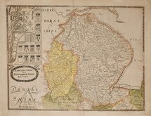
Christopher Saxton 1579 [1693]
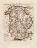
Richard Blome 1673
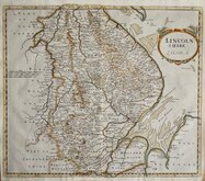
Robert Morden 1695
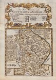
Emanuel Bowen 1720
Thomas Read 1744 [1769]
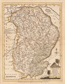
Thomas Kitchin 1763
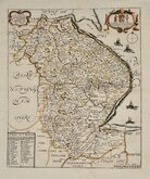
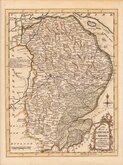
Joseph Ellis 1765 [1773]
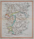
Nathaniel Coltman 1806 [1809]


20x26 cm
FINELY ENGRAVED MAP WITH PASTORAL TITLE CARTOUCHE
A Modern MAP of LINCOLN - SHIRE. Drawn from the latest Surveys: Corrected & Improved from the best Authorities. J.Ellis Sculpt.
Printed for Carington Bowles in St. Pauls Church yard & Robt. Sayer in Fleet Street.
First published in The New English Atlas… in 1765, the atlas became a considerable success with many editions, under the title Ellis's English Atlas, being published over a period of thirty years from the offices of Robert Sayer and Carington Bowles. Its popularity was due to it's cartographical clarity while being of pocket size making it useful for the traveller as well as everyday use in academies and the home. Most of the maps were copied from those by Thomas Kitchin in a rival publication of similar pocket size by Robert DodsleyEngland Illustrated first published in 1763 but which, without the commercial abilities of Sayer and Bowles, did not achieve the same success.
Tiny repairs verso to small holes at border top and bottom, the engraved line bottom border with small loss, but still a very good example from the 1773 edition of Ellis's English Atlas.
Ref. Carroll Printed Maps of Lincolnshire 40 (i)
Quick Links

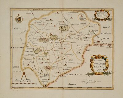
Rutland Maps

Nottinghamshire Maps
×