
Cambridgeshire Maps
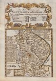
Lincolnshire Maps
( Page 1 of 3 )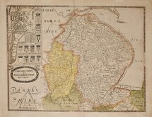
Christopher Saxton 1579 [1693]
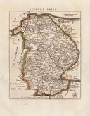
Richard Blome 1673
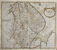
Robert Morden 1695
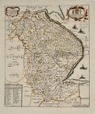
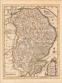
Emanuel Bowen 1720
Thomas Read 1744 [1769]
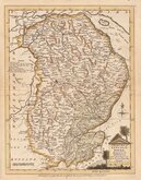
Thomas Kitchin 1763
Joseph Ellis 1765 [1773]
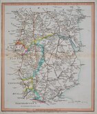
Nathaniel Coltman 1806 [1809]


26x30 cm
ROAD MAP COVERING THE WHOLE OF LINCOLNSHIRE
Continuation of the Roads to GLASGOW, and EDINBURGH, as far as Abberford, and YORK, with Roads to Hull, (by Lincoln) & Barton Ferry.
(ROADS MEASURED FROM TYBURN TURNPIKE AND HICKS'S HALL)
E. Jones sculpt.
Published 12.th Feb.y1806, by LAURIE & WHITTLE, N.o53 Fleet Street London.
Prepared by Nathaniel Coltman for publication in Laurie and Whittle's New Travellers Companion...in England Wales and Scotland...London, Laurie & Whittle, 1806.
Engraved by Edward Jones (fl.1799-1818). Little is known for certain about his early life but in partnership with Benjamin Smith he was trading as “Jones and Smith” or “Smith & Jones” 1799-1801 and then also with Joseph Bye as “Jones, Smith & Bye” or “Jones, Smith & Co.” 1801-1804. He was imprisoned in the Kings Bench for debt in July 1806.
Light stain from pasted guard verso but a good example from the third edition corrected to 1809.
Quick Links


Nottinghamshire Maps
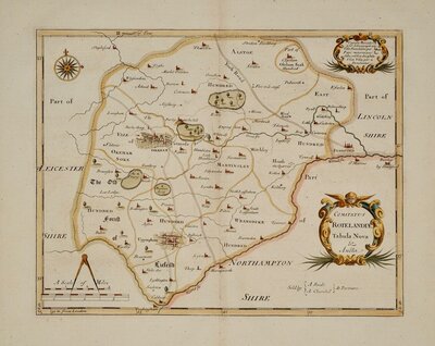
Rutland Maps
×