
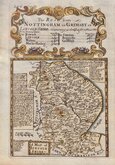
Nottinghamshire Maps
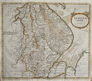
Lincolnshire Maps
( Page 1 of 3 )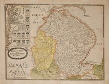
Christopher Saxton 1579 [1693]
Richard Blome 1673
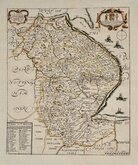
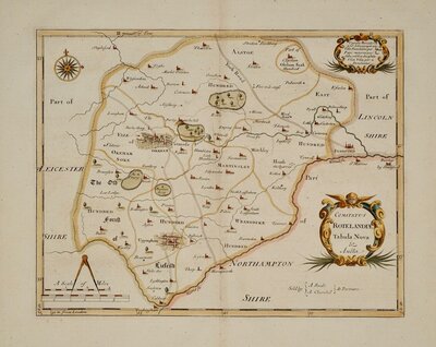
Robert Morden 1695
Emanuel Bowen 1720
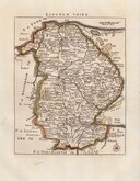
Thomas Read 1744 [1769]
Thomas Kitchin 1763
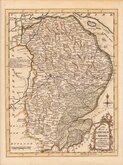
Joseph Ellis 1765 [1773]
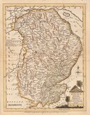
Nathaniel Coltman 1806 [1809]


19x25 cm
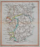
EARLY STEEL ENGRAVING.
LINCOLNSHIRE
Eng.d by Gray & Son
Pub.d by Arch.d Fullarton & C.o Glasgow.
Steel engraving by Gray & Son first published in Bell's New and Comprehensive Gazetteer in 1833. The text for the gazetteer was largely copied from Lewis' Topographical Dictionary of 1831 and in 1839 Lewis obtained an injunction against Bell for plagiarism and the work was withdrawn. Archibald Fullarton, the publisher of Bell's Gazetteer republished the maps with new text in The Parliamentary Gazetteer from 1840 until 1849. Most of the maps were also copied from those in an earlier topographical dictionary, the maps by Sidney Hall prepared for John Gorton's Topographical Dictionary of Great Britain and Ireland published in 1831 as a rival to Lewis' work.
Includes a vignette of Alnwick Castle.
Robert Gray (1771?-1848), Scottish engraver, lithographer and copperplate printer, trading from Glasgow as "Gray & Todd" between 1804 and 1806 and as "Gray & Son" from 1825 to 1848, initially with his son John, and later with his son James who continued the business after Robert Gray's death until at least 1856.
Fine hand coloured example from the first state of the plate published between 1833 and 1843.
Ref. Carroll Printed Maps of Lincolnshire 99 (i)
Quick Links


Cambridgeshire Maps
Rutland Maps
×