
Road Maps
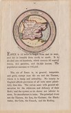
Essex Maps
( Page 2 of 5 )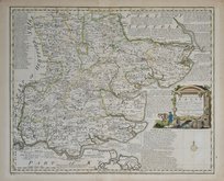
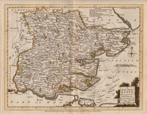
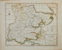
Emanuel Bowen 1763
Joseph Ellis 1765 [1773]
Emanuel Bowen 1767 [1785]
John Haywood 1787
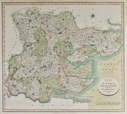
John Cary 1801

Samuel John Neele 1803
John Luffman 1803
John Cary 1808 [1809]


43x35 cm
FIRST TO SHOW LONGITUDE FROM LONDON & LOCAL TIME
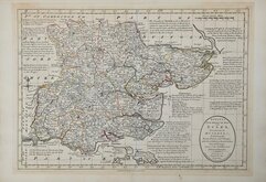
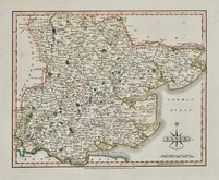
ESSEX By Rob.t Morden.
Sold by {A. Swall A. Churchill } & Partner
Sutton Nicholls sculp:
Copper engraving produced by Robert Morden for publication in Edmund Gibson's translation of William Camden's Britannia first published by Abel Swalle and Awnsham & John Churchill in 1695. Sutton Nichols and John Sturt have signed some of the maps as engravers but other engravers were also probably employed.This is the first series of maps to mark longitude in minutes of time (top border) as well as in degrees (bottom border). For most counties longitude is based on the meridian of St. Paul's, London. They were the first folio sized series of county maps to show roads, Morden using the survey and strip road maps of John Ogilby (published in his road book, also entitled Britannia, in 1675). Morden's miniature maps produced on a set of playing cards in 1676, shortly after Ogilby’s production, were the first complete set of county maps to include roads. Morden did not use Ogilby's standardisation of measure for the mile at 1760 yards and used the somewhat arbitrary approximation of local variations to include three scales, 'Great', 'Middle' and 'Small' miles on his maps.
The work was republished in 1722, 1730, 1753 and, finally in 1772. The plate was updated for the 1722 edition mostly with changes to place name spellings and was reworked for the 1753 edition due to wear on the plate.
The Essex map is signed by engraver Sutton Nichols (1668-1729). Born in Kent, he was apprentice or journeyman to mapmaker Philip Lea (fl.1683-1700). His known works include maps for many prominent mapmakers including Philip Lea, James Moxon, John Thornton, Henry Overton and John Bowles. He is recorded working from a number of addresses in Cheapside and Aldersgate from 1692 to 1716. He was buried at St. Dunstan in the East 28 October 1729.
Good impression from the re-worked plate of the 1753 edition. Good strong paper, no repairs, good margins, some minor offsetting* but overall a crisp clean map in very good later hand colour.
* Offsetting: A "ghostly" mirror image caused by evaporation from ink, or colouring, when a map is folded or stacked on other maps before the ink, or colour, is completely dry.
Quick Links

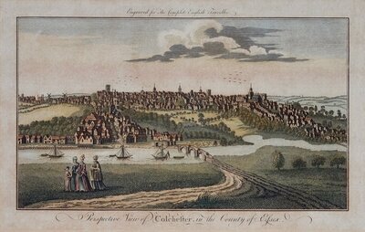
Essex Prints

Hertfordshire Maps
×