
Hertfordshire Maps
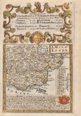
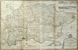
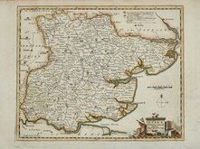
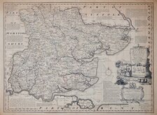
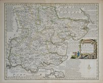
Essex Maps
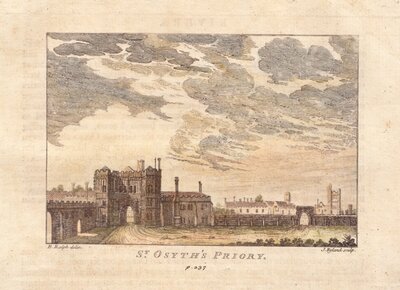
( Page 1 of 5 )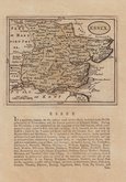
John Seller 1694 [1784]
Emanuel Bowen 1720
Warburton Bland & Smyth 1726
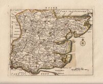
Thomas Read 1746 [1769]
Thomas Kitchin 1748 [1786]
Emanuel Bowen 1749
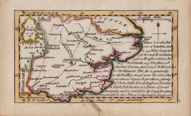
John Gibson 1759
Emanuel Bowen 1763


55x49 cm
FIRST EDITION OF CARY'S FOLIO MAP
A NEW MAP OF ESSEX, DIVIDED INTO HUNDREDS, EXHIBITING Its Roads, Rivers, Parks &c. By JOHN CARY, Engraver. 1805.
London Published by J.Cary Engraver & Map seller No.181 Strand Sep.r28.1801.
John Cary (c.1754-1835) began sales of his series of folio county maps in parts issues from 1801, the complete series being published in Cary's New English Atlas in 1809. Although closely modelled on the series by Charles Smith published five years earlier, the high quality production was deservedly successful, running to over ten editions before Cary's death. The plates passed to G F Cruchley about 1846 and to Gall and Inglis in 1877 and were issued by both publishers under various titles by lithographic transfer with continuous amendments, particularly to the rapidly changing railway network. until their final appearance in Cruchley's railway and telegraphic county atlas of England and Wales published by Gall and Inglis about 1887.
In addition to this extended publication in atlas form, the maps were also issued continuously from 1801 to 1890 as folding maps sold separately. The plates were probably disposed of as scrap metal during the first world war.
A very good example of the Essex map from the first edition dated 1801 in full original hand colour.
Quick Links


Road Maps
Essex Prints
×