
Hertfordshire Maps
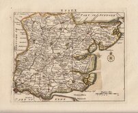
Essex Maps
( Page 1 of 5 )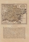
John Seller 1694 [1784]
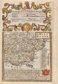
Emanuel Bowen 1720
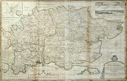
Warburton Bland & Smyth 1726
Thomas Read 1746 [1769]
Thomas Kitchin 1748 [1786]
Emanuel Bowen 1749
John Gibson 1759
Emanuel Bowen 1763


33x23 cm
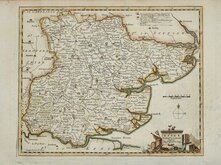
ATLAS ANGLICANUS, BOWLES EDITION.
BOWLES’s NEW MEDIUM MAP OF ESSEX, Divided into its HUNDREDS Exhibiting the Roads, Towns and Villages; with their Distance from London. Church Livings, Seats of the Nobility, and Historical Remarks. LONDON; Printed for the Proprietor Carington Bowles, N.o 69 in S.t Pauls Church Yard.
Published as the Act directs. 3 Jan.1785.
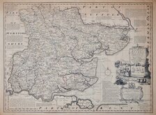
This series of maps were based on the large maps produced for the Large English Atlas by Thomas Kitchin and Emanuel Bowen from about 1749. Various publishers were involved in the troubled and expensive production of the large maps and the subsequent productions of smaller maps in the Royal English Atlas and Atlas Anglicanus were attempts at recouping some of the expenses incurred for the original surveys and publication.
Neither of the smaller derivatives achieved the sales success made by the Large English Atlas and surviving examples are uncommon.
There were three issues of Atlas Anglicanus with maps having a rococo title cartouche in 1767, 1770 and 1777. The plates were then acquired by Thomas Bowles who erased the decorative title cartouche, replacing it with a simple oval title panel publishing them in his New Medium Atlas in 1785 with individual county maps being offered for sale until at least 1798.
Emanuel Bowen’s son, Thomas, worked with him on this, his final work, the publication of which coincided with Emanuel’s death in 1767.
Very good example in original outline hand colour with the imprint of Carington Bowles published in his New Medium Atlas in 1785. Uncommon.
Quick Links


Road Maps
Essex Prints
×