
Hertfordshire Maps
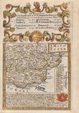
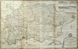
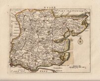
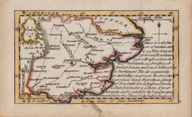
Essex Maps
( Page 1 of 5 )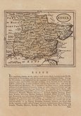
John Seller 1694 [1784]
Emanuel Bowen 1720
Warburton Bland & Smyth 1726
Thomas Read 1746 [1769]
Thomas Kitchin 1748 [1786]
Emanuel Bowen 1749
John Gibson 1759
Emanuel Bowen 1763


49x39 cm
ROYAL ENGLISH
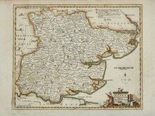
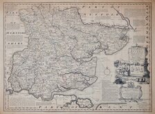
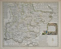
An Accurate Map of the COUNTY of ESSEX Divided into Hundreds; Drawn fromSurveys, & Illustrated w.th Historical Extracts relative to its Natural Produce, Trade and Manufactures; distinguishing also the Church Livings, Charity, Schools, Religious houses &c., By John Gibson. Revised, Corrected & improved by Emanuel Bowen Geographer to his Majesty.
No.13. | Printed for John Bowles and Son at the Black Horse, and Mess: Bakewell & Parker in Cornhill, T. Bowles in S.t Pauls Church Yard, H.Overton without Newgate, T.Kitchin on Holborn Hill, R.Sayer and J.Ryall in Fleet Street.
This series of maps, produced for The Royal English Atlas, were a reduction by two thirds of the maps from The Large English Atlas and were first published in 1763 only three years after the first complete issue of the Large English Atlas. There were a number of re-issues in the 1770's and 1780's with the final publication in 1828 by R. Martin but the publications were small and the work was not a commercial success, the maps are scarce today.
This map of Essex, with the imprint of six publishers, is from the first edition of 1763. Some browning to paper edges particularly verso but with good margins (4cm all round) the map remains clean. Original colour to map and good later colour to cartouche.
A nice example from the first edition.
Quick Links


Road Maps
Essex Prints
×