
Whole of Yorkshire
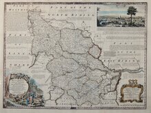
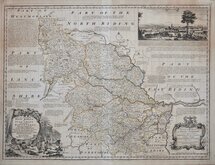
Yorkshire West Riding
( Page 1 of 3 )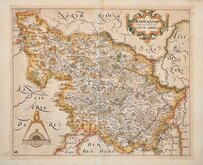
William Hole 1607 [1610]
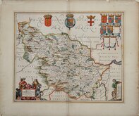
Jan Jansson 1646
Robert Morden 1695
Robert Morden 1695 [1730]
Emanuel Bowen 1720
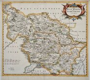
Kitchin & Jefferys 1749
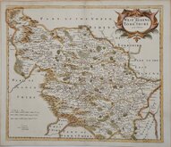
Emanuel Bowen 1750 [1753]
Emanuel Bowen 1750 [1763]


14x18 cm
FINE SCARCE MAP. FIRST EDITION.
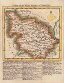
A Map of the WEST RIDING of YORKSHIRE.
Copper engraving by Thomas Kitchin and published in The Small English Atlas being a New and Acurate Sett of Maps of all the Counties in England and Wales....Publish'd according to Act of Parliamt. by Messrs. Kitchin & Jefferys 1749.
There was a single edition within Thomas Jefferys' lifetime but after his death in 1771 his material passed to Robert Sayer who published four editions before his death in 1794, the plates passing to Laurie and Whittle who published a final edition c.1796. Despite the number of editions, maps from any edition are scarce.
Early first edition, without plate number and the list of towns below the map not in alphabetical order. The impression also shows remains of the engravers' grid and lettering guidelines, a clear indication of a very early impression, these faint guidelines being worn away during the early pulls from the plate.
Fine example of a scarce map in bright original hand colour.
Ref. Whitaker Printed Maps of Yorkshire [200]
SPECIAL OFFER MOUNT OPTION AVAILABLE AT CHECKOUT FOR UK POSTAGE
Quick Links


Yorkshire East Riding

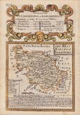
Yorkshire North Riding
×