
Yorkshire East Riding
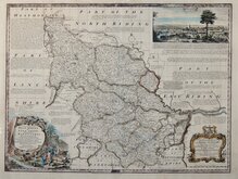
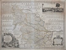
Yorkshire West Riding
( Page 1 of 3 )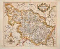
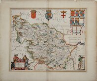
William Hole 1607 [1610]
Jan Jansson 1646
Robert Morden 1695
Robert Morden 1695 [1730]
Emanuel Bowen 1720
Kitchin & Jefferys 1749
Emanuel Bowen 1750 [1753]
Emanuel Bowen 1750 [1763]


12x18 cm
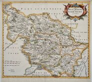
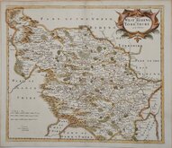
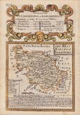
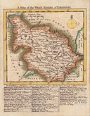
FROM "OWEN & BOWEN" POCKET ROAD BOOK BRITANNIA.
THE WEST RIDING of YORK-SHIRE
Map set below a decorative cartouche containing the title and details of the road from Ferrybridge to Boroughbridge.
Road map of the final part of the route fromPlymouth to Dartmouth verso.
Engraved text descriptions below the county map and alongside and below the road map.
Engraved by Emanuel Bowen (1693?-1767) and published in the pocket road book Britannia Depicta by Thomas Bowles from 1720 to 1764. The county maps were based on Robert Morden's small series published in The New Description and State of England... from 1701. Text descriptions compiled by John Owen.
Fine example in fine later hand colour.
For full description of the road, go to category: Maps > British Isles > RoadMaps > Owen & Bowen. For more information on Britannia Depicta, see the category heading under Road Maps > Owen & Bowen.
Ref. Whitaker Printed Maps of Yorkshire [161]
Quick Links


Whole of Yorkshire

Yorkshire North Riding
×