
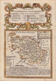
Yorkshire East Riding
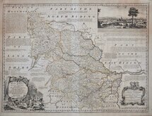
Yorkshire West Riding
( Page 1 of 3 )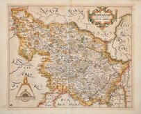
William Hole 1607 [1610]
Jan Jansson 1646
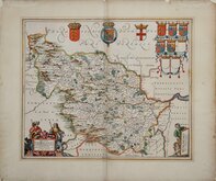
Robert Morden 1695
Robert Morden 1695 [1730]
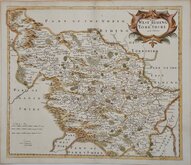
Emanuel Bowen 1720
Kitchin & Jefferys 1749
Emanuel Bowen 1750 [1753]
Emanuel Bowen 1750 [1763]


24x18 cm
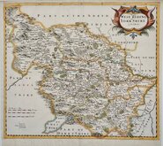
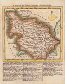
WESTERN PART OF THE WEST RIDING
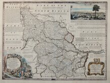
YORKSHIRE, WEST RIDING.
Drawn & Engraved by J. Archer, Pentonville, London.
First published in Curiosities of Great Britain, England and Wales Delineated…by Thomas Dugdale by L.Tallis in 1842. The work was re-issued a number of times until 1860. The maps also appeared in The Universal English Dictionary…by the Rev. James Barclay and finally in Tallis's topographical dictionary of England & Wales in 1860.
Joshua Archer (c.1792-1863), Engraver, cartographer and copperplate printer, was born in Barnstaple in Devon. His first recorded work as an engraver was a map of Scotland for Robert Wilkinson in 1814. He was declared bankrupt in 1835, imprisoned for debt in 1845 but recorded as a map and chart engraver aged 69, on the 1861 census, living in Islington with his wife, Jane, a son, John, also a map and chart engraver, Albert Archer, (map and chart draughtsman) and his wife Elizabeth and three children.
Showing part of the West Riding, this example, in original wash hand colour is from the 1858 edition of Dugdale's Curiosities. Some light offsetting.
Ref. Whitaker Printed Maps of Yorkshire [464]
Quick Links


Yorkshire North Riding

Whole of Yorkshire
×