
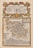
Yorkshire East Riding
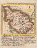
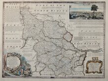
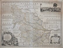
Yorkshire West Riding
( Page 1 of 3 )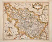
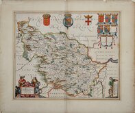
William Hole 1607 [1610]
Jan Jansson 1646
Robert Morden 1695
Robert Morden 1695 [1730]
Emanuel Bowen 1720
Kitchin & Jefferys 1749
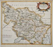
Emanuel Bowen 1750 [1753]
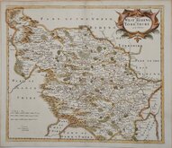
Emanuel Bowen 1750 [1763]


27x22 cm
PAIR OF MAPS. CARY'S "QUARTO" SERIES.
Pair of maps;
Part of the West Riding of YORKSHIRE By JOHN CARY Engraver.
London: Publish'd Jan.1.st1793 by J.Cary Engraver & Map-seller Strand.
Part of the West Riding of YORKSHIRE By JOHN CARY Engraver.
London: Publish'd Jan.1.st1793 by J.Cary Engraver & Map-seller Strand.
Copper engravings by John Cary. This series of maps, commonly known as his "quarto" series, were published in Cary's New and Correct English Atlas and were justifiably popular, running to many editions from 1787 until about 1804. Re-engraved plates extended the life of the series from 1808 to 1843 and lithographic transfers from the plates by later publishers continued publication until about 1876 - a life of nearly 90 years.
Final state of the plates published in Cary's New and Correct English Atlas... London 1793 [1808].
Original hand colour but with later red line to roads from Sheffield to Bawtry, Doncaster, and York.
Includes original page of typeset text description of the county with some near contemporary manuscript notes of the residents on the list of gentleman's seats.
Ref. Whitaker Printed Maps of Yorkshire [273]
Quick Links


Whole of Yorkshire

Yorkshire North Riding
×