
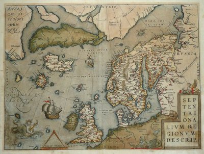
Atlantic & Poles
World Maps and Charts
( Page 1 of 4 )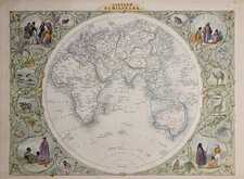
John Tallis Pair of Maps 1851
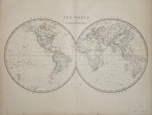
Keith Johnston 1869
Keith Johnston 1869
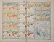
World Climate Bartholomew 1922
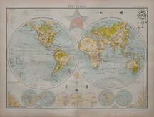
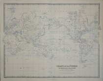
Bartholomew Twin Hemisphere 1898
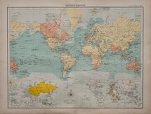
British Empire Bartholomew 1898
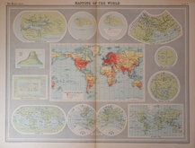
John Bartholomew 1922
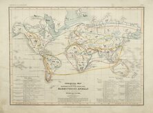
Petermann Mammals 1854


89x56 cm
The Times | SHIPPING NUMBER, FRIDAY, DECEMBER 13, 1912. | Commercial Chart | of | The World. | Shipping Routes | Distances | Comparative Greenwich Time
Inset detail of the Panama Canal with Table showing the shortening of sea routes effected by the opening of the Panama Canal.
Supplied by George Philip & Son, Ltd., | For The Times Shipping Number. above Key with Scale for the degree of Latitude. Steamer Routes with distances in Nautical miles. Principal Railways. Pacific Ocean Date Line. British Empire. Comparative time with Noon at Greenwich.
Clock symbols indicating comparative time with Noon at Greenwich across top border.
British Empire shown shaded on map.
The Times, Friday, December 13, 1912 to top left and top right margins.
Lightweight paper with watermark James Spicer & Sons. Paper size: 945mmx625mm.
Lithograph printed in two halves.
Folds and some creasing with pin hoes at some folds. some chipping at edges with slight loss to botttom edge at folds but well away from printed area and repaired verso with archival tape.
Quick Links

Historical Maps
Celestial
×