
Historical Maps
World Maps and Charts
( Page 1 of 4 )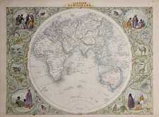
John Tallis Pair of Maps 1851
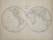
Keith Johnston 1869
Keith Johnston 1869
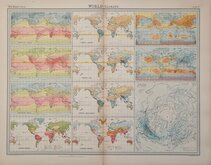
World Climate Bartholomew 1922
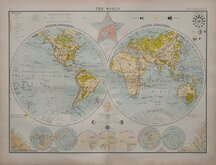
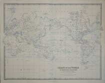
Bartholomew Twin Hemisphere 1898
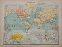
British Empire Bartholomew 1898
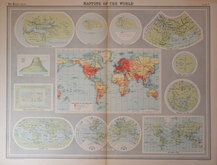
John Bartholomew 1922
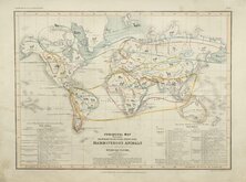
Petermann Mammals 1854

£25 British Empire Bartholomew
Ref: 1131.3
Add to
basket
Thanks,Your Product Has Been Added To Basket

42x32 cm
BRITISH EMPIRE
3 THE CITIZEN'S ATLAS 4
John Bartholomew & Co. Edinr.
Colour lithograph printed map by John George Bartholomew (1860-1920), geographer and cartographer to King George V. and successor to the famous mapmaking and engraving business founded by his great-grandfather George Bartholomew (1784-1871). Published in Bartholomew's Citizen's Atlas of the World...George Newnes, London 1898.
Showing the British possessions and Steamer and sailing routes, Railways, Caravan routes, Telegraph cables, and principal exports.
Two inset maps on lower border show Russian and Dutch possessions and German and French possessions.
Repair to lower centrefold slit just reaching map border.
Quick Links

Celestial
Atlantic & Poles
×