
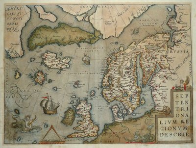
Atlantic & Poles
World Maps and Charts
( Page 1 of 4 )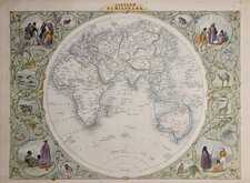
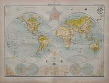
John Tallis Pair of Maps 1851
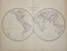
Keith Johnston 1869
Keith Johnston 1869
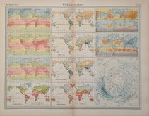
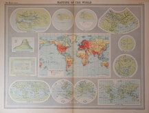
World Climate Bartholomew 1922
Bartholomew Twin Hemisphere 1898
British Empire Bartholomew 1898
John Bartholomew 1922
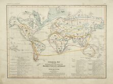
Petermann Mammals 1854


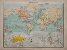
60x46 cm
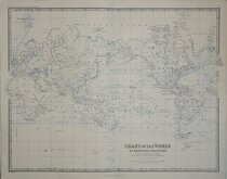
CHART OF THE WORLD ON MERCATORS PROJECTION
Showing the direction of the Ocean Currents, with the Routes and Distances between Ports.
by Keith Johnston, F.R.S.E.
Engraved & Printed | by W.& A.K. Johnston, Edinburgh.
William Blackwood & Sons, Edinburgh & London.
Large lithographic printed map published in The Royal Atlas Of Modern Geography Exhibiting, in a series of entirely original and authentic maps, the present condition of geographical discovery and research in the several countries, empires, and states of the World by Alexander Keith Johnston geographer to the Queen for Scotland...William Blackwood & Sons Edinburgh and London MDCCCLXIX.
Overprinted in blue indicating rivers, lakes, sea names, ocean currents, shipping routes, and graticule with hand colouring to continents.
A finely engraved map from the first edition of Johnston's atlas in good clean condition.
Quick Links
Celestial

Historical Maps
×