
Atlantic & Poles
World Maps and Charts
( Page 1 of 4 )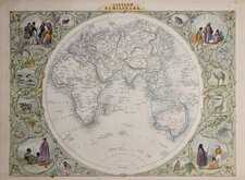
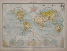
John Tallis Pair of Maps 1851
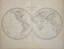
Keith Johnston 1869
Keith Johnston 1869
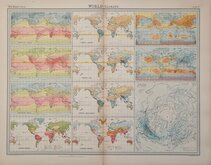
World Climate Bartholomew 1922
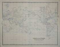
Bartholomew Twin Hemisphere 1898
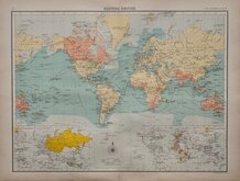
British Empire Bartholomew 1898
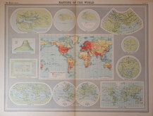
John Bartholomew 1922
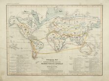
Petermann Mammals 1854


55x42 cm
MAPPING OF THE WORLD
Colour printed lithograph published by Bartholomew & Son. Ltd. in The Times Survey Atlas and Gazetteer of the World. 1922
Map titled CARTOGRAPHY OF THE WORLD 1921 surrounded by historical maps titled: HERODOTUS B.C.450, STRABO A.D.18, MELA A.D.43 PTOLEMY A.D.150, WHEEL MAP XI Century, HEREFORD MAP 1280, THE WORLD c.1800, DE WIT c.1700, ORTELIUS 1570, COSMAS INDICOPLEUSTES VI Century, MOUNTAIN OF COSMAS INDICOPLEUSTES .
Repairs to loss at both top corners outside printed area.
Quick Links

Historical Maps
Celestial
×