
Historical Maps
World Maps and Charts
( Page 1 of 4 )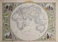
John Tallis Pair of Maps 1851
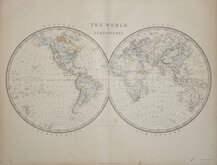
Keith Johnston 1869
Keith Johnston 1869
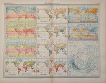
World Climate Bartholomew 1922
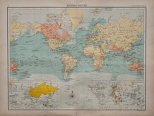
Bartholomew Twin Hemisphere 1898
British Empire Bartholomew 1898
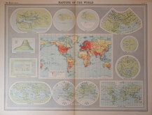
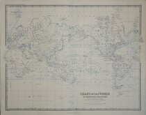
John Bartholomew 1922
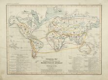
Petermann Mammals 1854

£20 Bartholomew Twin Hemisphere
Ref: 1131.1
Add to
basket
Thanks,Your Product Has Been Added To Basket

43x32 cm
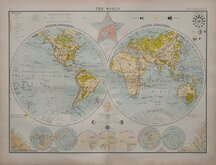
THE WORLD
1 THE CITIZEN'S ATLAS 1
John Bartholomew & Co. Edinr.
Colour lithograph printed map by John George Bartholomew (1860-1920), geographer and cartographer to King George V. and successor to the famous mapmaking and engraving business founded by his great-grandfather George Bartholomew (1784-1871). Published in Bartholomew's Citizen's Atlas of the World...George Newnes, London 1898.
Twin hemisphere physical map with sea currents.
Surrounding maps and charts showing:
COMPARATIVE SIZES OF THE SUN AND PLANETS
ORBITS AND COMPARATIVE DISTANCES OF THE PLANETS
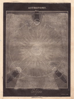
SOLAR and LUNAR ECLIPSE
PHASES OF THE MOON and TIDES
THE WORLD Berghaus's Star Projection
SEASONS IN THE NORTHERN HEMISPHERE
Comparative charts of the Hills of AMERICA & OCEANA and ASIA, AFRICA & EUROPE
NORTHERN AND SOUTHERN HEMISPHERES
COMPARATIVE POPULATIONS OF THE CONTINENTS
COMPARATIVE AREAS OF THE CONTINENTS
COMPARATIVE AREAS OF THE OCEANS
LAND AND WATER HEMISPHERES
Repaired split at lower centrefold extending to the chart of comparative continents.
Quick Links

Celestial
Atlantic & Poles
×