
Celestial
World Maps and Charts
( Page 1 of 4 )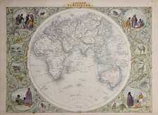
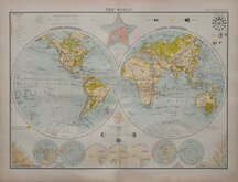
John Tallis Pair of Maps 1851
Keith Johnston 1869
Keith Johnston 1869
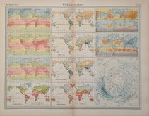
World Climate Bartholomew 1922
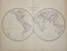
Bartholomew Twin Hemisphere 1898
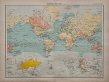
British Empire Bartholomew 1898
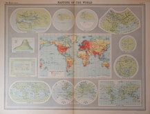
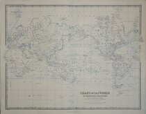
John Bartholomew 1922
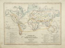
Petermann Mammals 1854


60x50 cm
MOUNTAIN CHAINS | IN | ASIA & EUROPE | BY DR. H. BERGHAUS OF GEOGRAPHY, BERLIN.
Edinburgh: John Johnstone and W.& A.K. Johnston: Glasgow: Robert Weir _ Lumsden & Son.
Large steel engraving by W & A K Johnston from their National Atlas of 1843.
Includes insets of the Island of Reguain (Ye Insel Island off Cheduba or Munaung Island, Myanmar.), Geological map of Java (hand coloured) , A Comparative view of the heights of the Great Mountain Chains and a cross section of Asia and The Volcanic Kingdom of Luzon in the Phiippines.
Original hand colour. Closed tear right margin not affecting printed area.
Quick Links

Historical Maps
Atlantic & Poles
×