
Road Maps
Waterways & Railways
( Page 1 of 2 )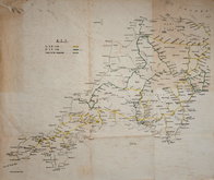
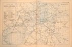
Railways Anonymous 1950
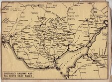
Southall's Railway Map South Wales 1900
John Roper 1809
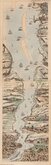
Thames London Ramsgate 1830
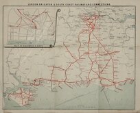
London Brighton Railway 1910
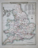
G W Bacon 1900
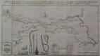
James Baker Thames 1802
Canal, Leeds to Selby 1774


41x35 cm
ANONYMOUS RAILWAY MAP
Untitled and anonymous lithographic map of Cornwall and Devon showing the Great Western (hand coloured in yellow) and Southern Railway (hand coloured green) lines and lines to be inspected (hand coloured broken green) in Cornwall, most of Devon and part of Somerset. The key refers to the lines as 'Ex G W' and 'Ex S R' suggesting that the map was produced shortly after the closure of these companies and the creation of British Rail in 1948.
Folds, some creasing and marking, offsetting and toned areas. Repair to damage in blank area top left corner.
Quick Links


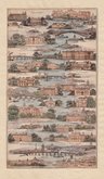
Town Plans

London Maps
×