
London Maps
Waterways & Railways
( Page 2 of 2 )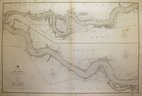
River Thames by Walker 1857
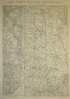
Great Western Railway by Weller 1863
Great Western Railway by Weller 1863
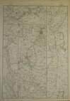
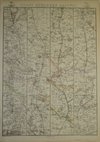
North Western Railway by Weller 1863
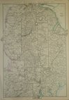
Great Northern Railway, Weller 1863
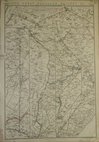
Great Northern Railway, Weller 1863
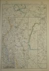
Eastern Counties Railway by Weller 1863
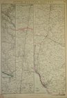
South Eastern Railway by Weller 1863


97x64 cm
Large chart of the Thames from London to Gravesend by The Hydrographic Office of the Admiralty surveyed by Captain Bullock and Lieutenant Burstal 1830-33 and dated July 25th 1856 with corrections to 1857. Engraved by J & C Walker.
.Quick Links


Town Plans

Road Maps
×