
London Maps
Waterways & Railways
( Page 1 of 2 )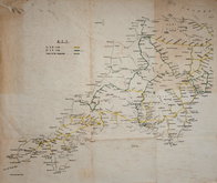
Railways Anonymous 1950
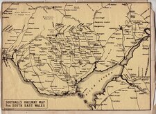
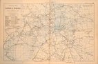
Southall's Railway Map South Wales 1900
John Roper 1809
Thames London Ramsgate 1830
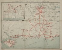
London Brighton Railway 1910
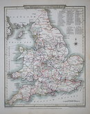
G W Bacon 1900
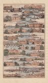
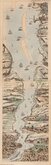
James Baker Thames 1802
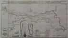
Canal, Leeds to Selby 1774


10x19 cm
James Baker published a series of guides with various titles at the beginning of the 19th century. The earliest dated title pages are 1802 but there were issues without title pages and some plates have dated imprints from 1798. There is also topographical evidence suggesting production began in the late 1790's. Baker's production methods were somewhat haphazard and works under the same title and date often contained differing numbers of plates. The guides were variously titled including The Imperial Guide…The Intelligent Traveller and Picturesque Guide…Fashionable Tours from London…The Atlas of English Towns… dated from 1802 to 1806.
The maps were printed by the aquatint process, usually hand coloured at the time of production and usually depicted roads as a dotted line commencing at the bottom of the page winding between vignettes of towns, country seats and landmarks to the top of the page. The vignettes, which Baker claims are from 'original sketches' are generally accurate, if somewhat stylised, views with prominence given to country seats. Like his contemporaries, Baker encouraged patronage of the wealthy by giving emphasis to their houses on the map.
Despite the number of titles employed by Baker, the scarcity of surviving examples suggest his works achieved limited success.
This map depicts the route of the Thames from Lambeth Palace to Eton and Windsor. The map is trimmed to margin and pasted on old paper but it remains an attractive, detailed and scarce map in original hand colour.
Quick Links


Road Maps

Town Plans
×