
Surrey Maps
Sussex Maps
( Page 1 of 4 )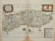
Richard Blome 1673
Robert Morden 1695
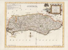
Emanuel Bowen 1720
Thomas Read 1744 [1769]
Thomas Kitchin 1763
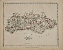
John Cary 1787 [1808]
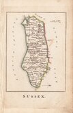
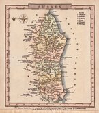
Robert Butters 1803
Charles Cooke 1810


9x13 cm
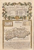
RARE "UPSIDE-DOWN" SERIES. THE ONLY MAP OF SUSSEX WITH NORTH TO THE RIGHT.
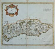
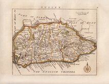
SUSSEX.
The engraver or engravers of this series of maps are unknown and the maps are referenced by the first publisher, Robert Butters, a Fleet Street printer, who issued them in An Atlas of England... in 1803. They are also known as the "upside-down series", the England map and many of the county maps being engraved with North to the bottom of the page. In fact, the county maps are variously orientated with North to the top, left, right or bottom of the page. The work was probably for school use and the odd orientation of the maps may have been intended to stimulate young minds. This represented Robert Butters' only serious venture into cartography but unlike the huge success of John Cary's publication The Traveller's Companion, on which these maps were based, Butter's publication was limited to this single issue. John Hatchard acquired the plates later the same year issuing them in a two-volume work The Picture of England 1803, and 1804. The publications were small and only a single copy of the Hatchard 1803 edition has been found.
The only printed map of Sussex to be orientated with North to the right.
Small stain to the paper alongside Ockley in Surrey and some fingermarking but still a good example of a rare miniature map in original hand colour.
Ref. Kingsley Printed Maps of Sussex 64
Quick Links


Kent Maps

Hampshire Maps
×