
Middlesex Maps
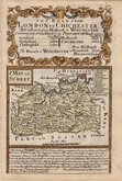
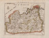
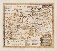
Surrey Maps
( Page 1 of 5 )
Jan Blaeu 1645
Richard Blome 1673
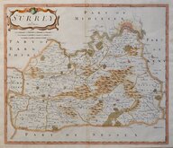
Robert Morden 1695 [1722]

Robert Morden 1695 [1722]
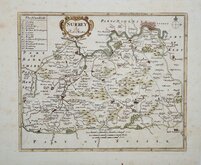
Robert Morden 1701 [c.1708]
Emanuel Bowen 1720
Thomas Read 1744 [1753]
Emanuel Bowen 1756


50x38 cm
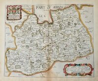
ATTRACTIVE DUTCH MAP COPIED FROM SPEED.
SURRIA Vernacule SURREY.
Copper engraving by Jan Blaeu (1596-1673) the son of William Janszoon Blaeu (1571-1638), founder of the famous Dutch publishing house. The county maps of England and Wales appeared in the fourth volume of their world atlas, Theatrum Orbis Terrarum in 1645. The work commenced publication with the first volume in 1630,meventually expanding to 12 volumes. The English county maps were closely copied from the 1623 edition of John Speed's Theatre of the Empire of Great Britaine, with the text verso, translated into various languages from William Camden's Britannia. The production of the maps was of the highest quality with consistently fine and uniform engraving embellished with decorative title cartouches and armorial bearings, the printing was carried out in Blaeu's own printing house, using the finest quality rag paper, the maps usually completed with hand colouring carried out within Blaeu's own workshops. The atlases containing the English county maps were published from 1645 until 1667, the maps remained unaltered throughout the publication period. The language and setting of the typeset text verso was changed for each edition, enabling the identification of a loose map. A fire at Blaeu's printing house in 1672 destroyed most of the plates and Jan Blaeu died the following year, effectively ending the Blaeu publishing dynasty.
Original hand colour. Latin text verso. Horizontal creases in lower blank margin 2cm clear of plate edge. Water stain to left and right paper edge, again well clear of plate edge.
Quick Links


Sussex Maps

Kent Maps
×