
Hampshire Maps
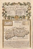
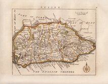
Sussex Maps
( Page 1 of 4 )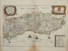
Richard Blome 1673
Robert Morden 1695
Emanuel Bowen 1720
Thomas Read 1744 [1769]
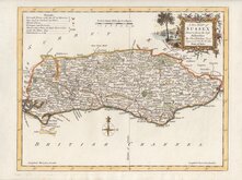
Thomas Kitchin 1763
John Cary 1787 [1808]
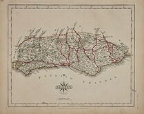
Robert Butters 1803
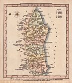
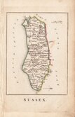
Charles Cooke 1810


11x13 cm
SMALL MAP WITH NORTH TO THE LEFT
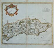
SUSSEX
Copper engraving first published in parts in A Topographical and statistical description of the county of…by George Alexander Cooke…Illustrated with a map of the county. London, C. Cooke 1806.
Further publications by Cooke followed under titles; The Modern British Traveller… & Topography of Great Britain… in 1810 & 1822. The maps were next issued, with plate numbers added, in Gray’s New Book of the Roads…by George Carrington Gray London, Sherwood, Jones and Co., 1824. Their final appearance was a republication of the first issue, London, Sherwood, Gilbert and Piper, “printed by assignment from the executors of the late C. Cooke”.
Remargined at bottom edge where close trimmed to the reference to the colours used on the Superior Edition. Neat hand colour, without plate number, issued from 1810 to 1822.
Ref. Kingsley Printed Maps of Sussex 69(i)
Quick Links


Surrey Maps

Kent Maps
×