
Kent Maps
Sussex Maps
( Page 1 of 4 )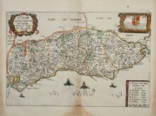
Richard Blome 1673
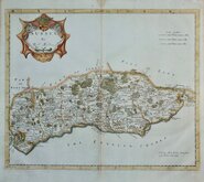
Robert Morden 1695
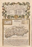
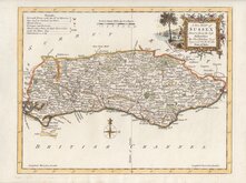
Emanuel Bowen 1720
Thomas Read 1744 [1769]
Thomas Kitchin 1763
John Cary 1787 [1808]
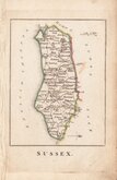
Robert Butters 1803
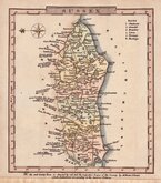
Charles Cooke 1810


44x30 cm
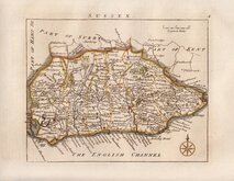
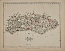
WEEKLY DISPATCH SERIES CASSELL EDITION
CASSELL'S COUNTY MAPS
SUSSEX
By B.R.DAVIES: FROM THE ORDNANCE SURVEY
Cassell, Petter & Galpin, Bell Sauvage Yard Ludgate Hill.
LONDON, PUBLISHED BY CASSELL, PETTER & GALPIN. LA BELLE SAUVAGE YARD, LUDGATE HILL, E.C.
Lithograph printed map engraved by Benjamin Rees Davies (c.1789-1872) first published in The Weekly Dispatch 10th October 1858. The maps were also published as loose sheets and, when the series was complete, in The Dispatch Atlas from 1863. The publishers Cassell Petter and Galpin acquired the plates publishing them as loose sheets from 1864 and in Cassell's Illustrated family paper and Cassell's British Atlas in 1867. By 1869, the firm of G. W. Bacon had acquired the plates and published them in a number of titles for over forty years.
This example of the map of Sussex is the fourth lithographic transfer, with statistical information in typeset text transferred to the lithographic plate, published in Cassell's British Atlas...London Cassell, Petter & Galpin 1867.
Hand colouring indicating the East and West divisions of the county.
Some creasing at centrefold.
Ref. Kingsley Printed Maps of Sussex 121 D.
Quick Links


Hampshire Maps

Surrey Maps
×