
Dorset Maps
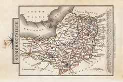
Somerset Maps
( Page 1 of 3 )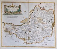
Robert Morden 1695 [1753]
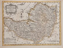
Thomas Kitchin 1749 [1769]
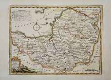
Thomas Kitchin 1763
Thomas Kitchin 1763
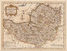
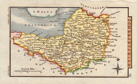
John Cary 1787 [1793]
George Cole 1810
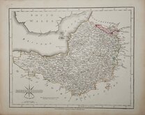
Sidney Hall 1820
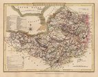
George & John Cary 1822


26x20 cm
"DUKE OF YORK" SERIES
A New MAP of SOMERSETSHIRE Drawn from the best Authorities: By Thos,,Kitchin Geogr,, Engraver to H. R. H. the Duke of York.
Copper engraving by Thomas Kitchin published in England Illustrated, or, a compendium of natural history, geography, topography… by Robert and James Dodsley in 1764. Kitchin (1719-1784), one of the foremost engravers of his time, was apprenticed to Emanuel Bowen in 1732 and married his daughter, Sarah, at the end of his apprenticeship in 1739. His works include the map of Scotland by Elphinstone, maps for Geographia Scotiae, the London Magazineand The Large English Atlas working with his father in law Emanuel Bowen. The publisher Robert Dodsley took his younger brother, James into partnership by 1755 and together published England Illustrated in December 1763 post-dated 1764. The work was re-issued in monthly parts early in 1764. Robert Dodsley died on 23rd September but publication of the monthly parts continued until completion on 1st January 1765. The maps appeared once more in 1765 in an atlas publication without text under the title Kitchen's English Atlas; Or, A Compleat Set of Maps Of All The Counties of England and Wales…By Thomas Kitchen, Geographer to his Royal Highness the Duke of York. London: Printed for J. Dodsley, in Pall-Mall.
Some highlighting of place names and roads in brown ink and pencil, pencilled notes on the county verso, printer's crease top right corner. Still an attractive map in neat hand colour.
Ref. Chubb Maps of Somerset p.50.
SPECIAL OFFER MOUNT OPTION AVAILABLE ON THIS ITEM AT CHECKOUT FOR UK CUSTOMERS.
Quick Links

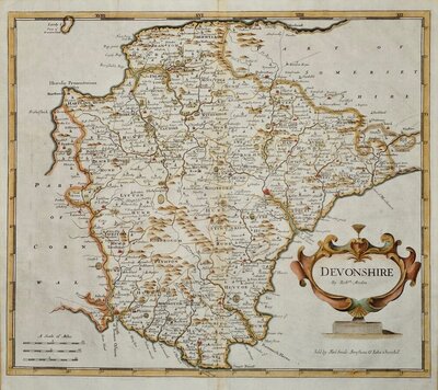
Devon Maps

Gloucestershire Maps
×