
Somerset Maps
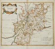
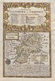
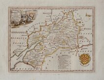
Gloucestershire Maps
( Page 1 of 3 )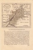
John Seller 1693 [c.1784]
Robert Morden 1695
Emanuel Bowen 1720
Thomas Kitchin 1751 [c.1786]
Thomas Kitchin 1763
Joseph Ellis 1765 [1773]
Robert Butters 1803
Neele Samuel 1805


15x13 cm
GROSE EDITION WITH TEXT BELOW & VERSO.
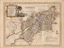
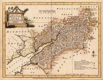
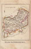
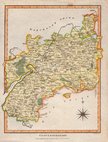
GLOUCESTER SHIRE.
John Seller (fl. 1660-1697), hydrographer to Charles II, James II and Queen Anne, is renowned for his sea charts published in 1671 under the title The English Pilot. In 1679 he began work on an ambitious project to make a new survey of the counties of England and Wales and prepare a new county atlas entitled Atlas Anglicanus. Despite financial support from the Treasury the scheme failed with only six counties completed. Probably as a means of restoring his finances, Seller prepared a series of small county maps, generally based on John Speed's maps of 1610, and published them under the titles Anglia Contracta, Camden's Britannia Abrig'd and The History of England. There were only two issues of the maps before his death in 1697 but they were printed again a few years later in reprints of The History of England and Camden's Britannia Abrig'd. A rare late edition of Camden's Britannia Abrig'd has been found published in 1711. The maps were not seen again for over 70 years when they were reworked (generally incorporating some place name revisions and a simplified title panel) and published in large numbers in the successful and popular work, Sir Francis Grose's Antiquities of England and Wales between 1784 and 1787*. These later 'Grose' editions included a typeset text printed description of the county below the engraved map and, for most counties, continued verso.
*1787 is the last given publication date for Grose's work but maps have been found with dated watermarks up to 1815.
Good example of the map of Gloucestershire from the Grose edition with simple cartouche and printed text on the page below and verso. Original green hand colour wash which has browned from the verdigris used in the pigment as usual.
SPECIAL OFFER MOUNT OPTION AVAILABLE AT CHECKOUT FOR UK POSTAGE
Quick Links


Wiltshire Maps
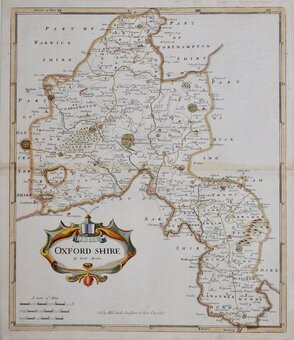
Oxfordshire Maps
×