
Road Maps
Regional Maps
( Page 1 of 10 )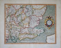
Gerard Mercator South East England 1630
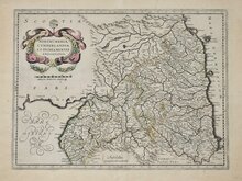
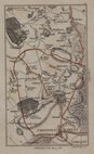
Cumberland Northumberland Durham 1639
Hertfordshire Part 1766
Essex Part Chapman and Andre 1777
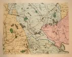
Essex Part Chapman and Andre 1777
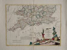
Southern Britain Zatta 1778
Kings Langley 1786
Barnet 1786


30x24 cm
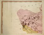
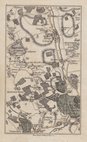
THE SIX HILLS, STEVENAGE.
From The Ordnance Survey_25 inches to mile.
Undated, crudely drawn lithograph printed map of the Roman barrows known as The Six Hills in Stevenage. Now a protected monument, they are situated in the centre of Stevenage alongside the A602 behind a supermarket complex. The map is based on the 1881 25 inch to the mile Ordnance Survey map surveyed in 1880.
Archival repair to 9cm tear right edge. Re-margined left edge with browning to edge. Prominent centrefold.
Quick Links


Folding Maps
Town Plans
×