
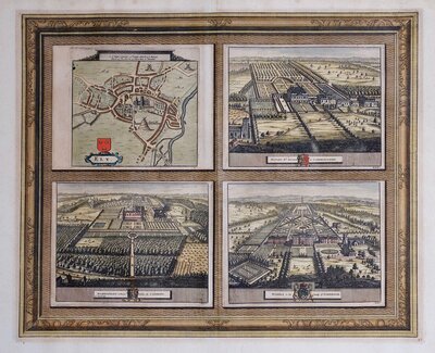
Town Plans
Regional Maps
( Page 1 of 10 )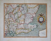
Gerard Mercator South East England 1630
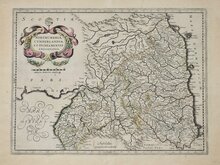
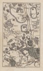
Cumberland Northumberland Durham 1639

Hertfordshire Part 1766
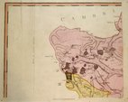
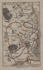
Essex Part Chapman and Andre 1777
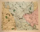
Essex Part Chapman and Andre 1777
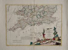
Southern Britain Zatta 1778
Kings Langley 1786
Barnet 1786

£90 Essex Part Chapman and Andre
Ref: 0581
Add to
basket
Thanks,Your Product Has Been Added To Basket

59x45 cm
Plate 1 from the twenty five plate large scale map of Essex by John Chapman and Peter André published in 1777.
Imprint: Publish'd as the Act directs Oc.t 1.st 1777. by John Chapman & Peter André.
The north west part of the county showing Great Chishall, Little Chishall, Heydon, Chrsihall, Elmdon, Strethall, Arkesden, Wickham Bonhunt, and Langley.
Good example in full original colour.
Quick Links

Road Maps

Folding Maps
×