
Town Plans
Regional Maps
( Page 3 of 10 )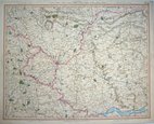
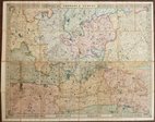
York 1825
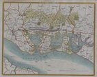
Portsmouth 1837
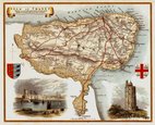
Thomas Moule Thanet 1842
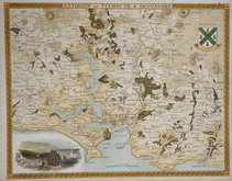
Plymouth & Devonport by Moule 1842
George Frederick Cruchley 1845
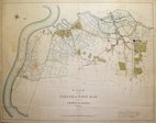
West Ham 1855
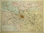
Environs of Glasgow 1867
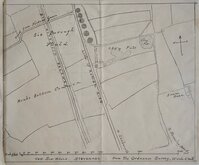
Six Hills Stevenage Herts 1880


65x53 cm
Sheet No. 49 from John Cary's large scale 65 sheet sectional map of England and Wales entitled: Cary's Improved Map of England and Wales with a considerable portion of Scotland Planned on a scale of Two Statute Miles to One Inch.
Extent: Knaresborough to Hull an Pontefract to to Thirsk.
Large copper engraving in original hand colour.
Fine condition.
Quick Links

Folding Maps

Road Maps
×