
Road Maps
Regional Maps of England & Wales
( Page 1 of 10 )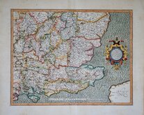
Gerard Mercator South East England 1630
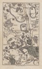
Cumberland Northumberland Durham 1639
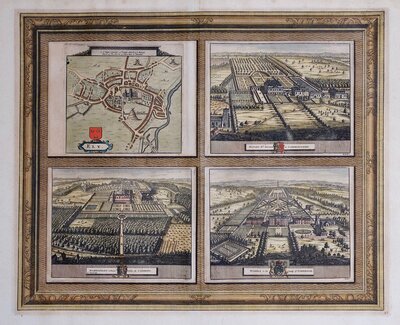
Essex Part Chapman and Andre 1777
Essex Part Chapman and Andre 1777
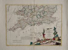
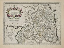
Southern Britain Zatta 1778
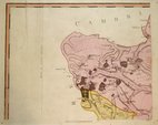
Kings Langley 1786
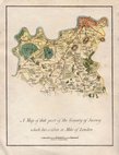
Barnet 1786
Cadell & Davies 1791


12x16 cm
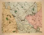
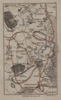
ROAD from LONDON to BATH &c. No.6
The sixth plate from the series of eleven maps engraved for A Topographical Survey of the Great Road from London to Bath and Bristol...by Archibald Robertson. London, William Faden, 1792.
Archibald Robertson (fl.1777-1796) was a print-seller and drawing master trading from Saville Row and, from 1782, Charles Street St. James's Square. Robertson is known as a landscape painter and for his aquatints, his first aquatints were jointly published with well known watercolourist, Paul Sandby (c1731-1809). In the above work, the aquatint views are all unsigned but are almost certainly by Archibald Robertson. The maps are also unsigned by engraver or surveyor but Robertson is not known for surveying or line engraving.
A very good and uncommon map of part of the road from London to Bristol passing through Berkshire showing Newbury, Hampsead Park, Enborne, Crockham Heath, Newtown, Greenham, Donnington, Speen, Marsh Benham, Woodspeen, Bagnor, Wickham Heath, Boxford, Winterbourne, Snelsmore, Donnington, Shaw.
Light waterstain to lower right corner affecting the engraved border otherwise clean and in fine hand colour.
Quick Links


Folding Maps
Town Plans
×