
Road Maps
Regional Maps
( Page 1 of 10 )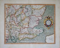
Gerard Mercator South East England 1630
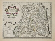
Cumberland Northumberland Durham 1639
Hertfordshire Part 1766
Essex Part Chapman and Andre 1777
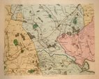
Essex Part Chapman and Andre 1777
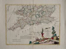
Southern Britain Zatta 1778
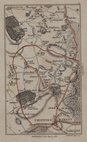
Kings Langley 1786
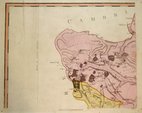
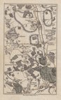
Barnet 1786


9x16 cm
Copper engraving by John Cary first published in his Actual Survey of Middlesex in 1786. The work was not re-issued as the plates were re-numbered and published later the same year and in 1800 and 1811 in his Actual Survey of the Counttry Fifteen Miles Round London.
This map showing the area from Elstree to London Colney, numbered plate 3 and with changes to some owners of the estates is from the 1800 edition of his 15 Miles Round London. Original hand colour.
Quick Links

Town Plans

Folding Maps
×