
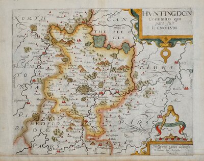
Huntingdonshire Maps
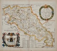
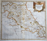
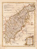
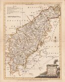
Northamptonshire Maps
( Page 1 of 3 )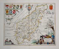
Jan Blaeu 1645 [1648]
Richard Blome 1673
Robert Morden 1695
Emanuel Bowen 1720
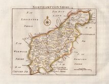
Thomas Read 1744 [1769]
Thomas Kitchin 1763
Joseph Ellis 1765 [1773]
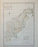
John Haywood 1788


56x42 cm
FINE EXAMPLE IN ORIGINAL HAND COLOUR
COMITATUS NORTHANTO~NENSIS; Vernacule NORTHAMPTONSHIRE.
Copper engraving published by the Dutch publishing house of Blaeu in their World Atlases from 1645 until 1667. A fire at Blaeu's printing house destoyed most of the plates in 1672 and Jan Blaeu died the following year effectively ending the Blaeu publishing dynasty.
The maps were closely copied from John Speed and the text verso translated into various languages from William Camden's Britannia. The production of the maps was of the highest quality with consistently fine and uniform engraving embellished with decorative title cartouches and armorial bearings, high quality printing from Blaeu's own printing house using the finest quality rag paper and usually completed with hand colouring carried out within Blaeu's own workshops.
Fine example in original hand colour. Latin text verso with page numbers 237 & 238 identifies this as the 1648 edition.
Ref. Whitaker Printed Maps of Northamptonshire 94
Quick Links

Warwickshire Maps

Leicestershire Maps
×