
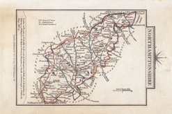
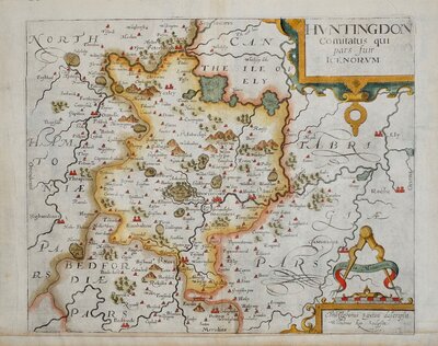
Huntingdonshire Maps
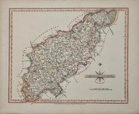
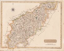
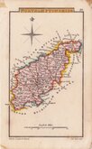
Northamptonshire Maps
( Page 2 of 3 )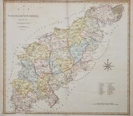
John Cary 1789 [1805]
John Cary 1793
Robert Butters 1803
George Cole 1807
John Cary 1808 [1809]
Samuel John Neele 1812
Sidney Hall 1820
John Cary 1822


49x44 cm
LARGE WELL ENGRAVED DETAILED MAP
A MAP of NORTHAMPTONSHIRE from the best AUTHORITIES published by John Stockdale Piccadilly, 26.th March 1805.
Engraved by J. Cary
Copper engraving by John Cary. The maps were first issued in parts by T. Payne & Son, and G.G.J. & J. Robinson for Richard Gough's translation of William Camden's Britannia, the completed work being published in 1789. Following the death of Payne, the Robinson family sold the plates and publication rights to John Stockdale. Richard Gough was reportedly annoyed with the new arrangements and refused to work on the new edition and Stockdale completed the editorial work himself, expanding the work to four folio volumes and publishing them in 1806. Stockdale also used the plates in his New British Atlas from 1805 to 1809.
This hand coloured example of Northamptonshire is from the Stockdale edition of 1805.
Small margins top and bottom. Archival tape repair verso to junction of horizontal and vertical folds as issued.. Some wrinkling to paper at fold intersection.
Ref. Whitaker Printed Maps of Northamptonshire 303.
Quick Links

Leicestershire Maps

Warwickshire Maps
×