
Warwickshire Maps
Northamptonshire Maps
( Page 1 of 3 )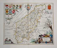
Jan Blaeu 1645 [1648]
Richard Blome 1673
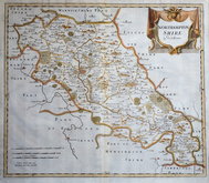
Robert Morden 1695
Emanuel Bowen 1720
Thomas Read 1744 [1769]
Thomas Kitchin 1763
Joseph Ellis 1765 [1773]
John Haywood 1788


41x33 cm
FIRST EDITION. NORTH TO THE RIGHT.
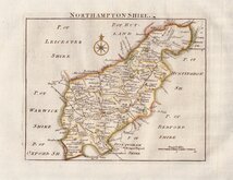
NORTHAMPTON SHIRE by Robt Morden
Copper engraving produced by Robert Morden for publication in Edmund Gibson's translation of William Camden's Britannia first published by Abel Swalle and Awnsham & John Churchill in 1695. This is the first series of maps to mark longitude in minutes of time (top border) as well as in degrees (bottom border). For most counties longitude is based on the meridian of St. Paul's, London.
The work was republished in 1722, 1730, 1753 and, finally in 1772. The plate was updated for the 1722 edition mostly with changes to place name spellings and was reworked for the 1753 edition due to wear on the plate.
Very good example from the first edition of 1695. North is to the right. Printers crease running vertically to left side of the map. Good margins, fine later hand colour.
Ref. Whitaker Printed Maps of Northamptonshire 145
Quick Links

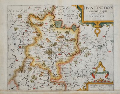
Huntingdonshire Maps

Leicestershire Maps
×