
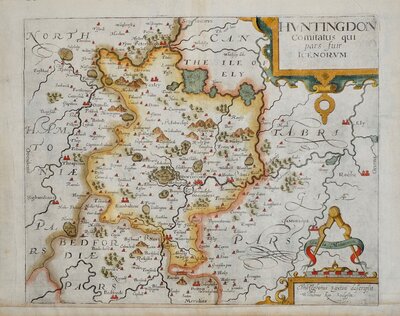
Huntingdonshire Maps
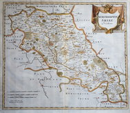
Northamptonshire Maps
( Page 1 of 3 )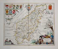
Jan Blaeu 1645 [1648]
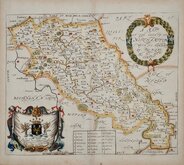
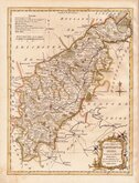
Richard Blome 1673
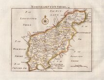
Robert Morden 1695
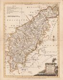
Emanuel Bowen 1720
Thomas Read 1744 [1769]
Thomas Kitchin 1763
Joseph Ellis 1765 [1773]
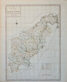
John Haywood 1788


32x26 cm
DECORATIVE EARLY MAP. NORTH TO THE RIGHT.
A MAPP OF THE COUNTY OF NORTHAMPTON WITH ITS HUNDREDS BY, RIC: BLOME; BY HIS MATYS COMAND.
Copper engraving published in Richard Blome's Britannia. Blome probably produced his Britannia in response to an advertisement by John Ogilby of his intention to produce a work of th same title. Blome's work was not original and the maps were mostly copied from those of John Speed and the text extracted from Camden. Engraved with North to the right, the Northamptonshire map was copied from William Smith's map of 1602.
Blome used journeymen engravers of average standard but he employed the services of the greatest printer of his time, Thomas Roycroft.
Fine example in fine later hand colour.
Ref. Whitaker Printed Maps of Northamptonshire 121.
MOUNTED OPTION AVAILABLE AT CHECKOUT ON THIS ITEM FOR UK POSTAL ADDRESSES
Quick Links

Leicestershire Maps

Warwickshire Maps
×