
Whole of Wales
North Wales
( Page 1 of 2 )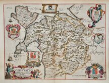
Richard Blome 1673
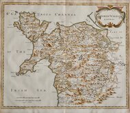
Robert Morden 1695
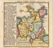
Thomas Badeslade 1742
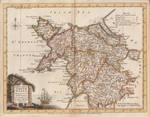
Joseph Ellis 1773
John Cary 1793
John Cary 1809
Samuel John Neele 1812
John Cary 1822


15x15 cm
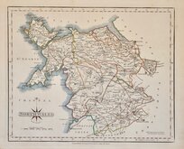
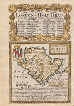
A Map of NORTH WALES N. West from London | T. Badeslade delin. W.H.Toms Sculpt | Published for the Proprietor W H Toms Sept.29.1742
William Henry Toms claimed to be the sole proprietor of this pocket atlas but the first title page and the early imprints on the maps indicate that Thomas Badeslade prepared the maps and Toms was the engraver. Within the first year of publication Badeslade's name was removed from the title page and imprints indicating that the partnership came to an early end (nothing is heard of Thomas Badeslade after this date and is possible that he died at this time). The title page of the atlas states that the maps were prepared for George I which would mean that they were drawn before 1727 and, as they were based on the maps by Herman Moll published in 1724, not before 1724. It is not known why publication was delayed until 1742. As the first 18th century county atlas to be truly pocket size, like it's road-book equivalent, Britannia Depicta, it was very successful running to several editions within the first year (including a number of changes to the plates) with publication continuing until the end of the decade.
This example of North Wales has a small bottom margin, as often found with these maps, but is a very good example in fine hand colour. North is to the right.
Quick Links

Welsh Counties
South Wales
×