
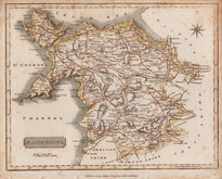
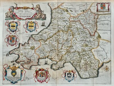
South Wales
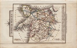
North Wales
( Page 1 of 2 )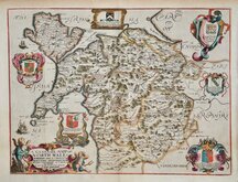
Richard Blome 1673
Robert Morden 1695
Thomas Badeslade 1742
Joseph Ellis 1773
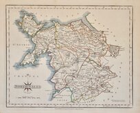
John Cary 1793
John Cary 1809
Samuel John Neele 1812
John Cary 1822


43x36 cm
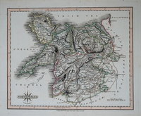
NORTH WALES
By Rob.t Morden.
Copper engraving produced by Robert Morden (fl.1669-1703) for publication in Edmund Gibson's translation of William Camden's Britannia first published by Abel Swalle and Awnsham & John Churchill in 1695. Engravers Sutton Nichols and John Sturt have signed some of the maps but probably other engravers were also employed.
This is the first series of maps to mark longitude in minutes of time (top border) as well as in degrees (bottom border). For most counties longitude is based on the meridian of St. Paul's, London. They were also the first folio sized series of county maps to show roads, Morden using the survey and strip road maps of John Ogilby published in his road book, also entitled Britannia, in 1675. Morden generally used three fairly arbitrary scales of 'Great', 'Middle' and 'Small' miles on his county maps but here he uses two scales defined simply as 'English Miles'.
The map of North Wales was replaced in the 1722 edition with a new map engraved with a simple title cartouche.
Small margins left and right but a very good example with the decorative title cartouche published in 1695. Fine later hand colour
Quick Links
Welsh Counties

Whole of Wales
×