
Northamptonshire Maps
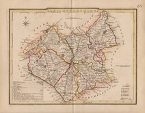
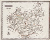
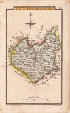
Leicestershire Maps
( Page 2 of 3 )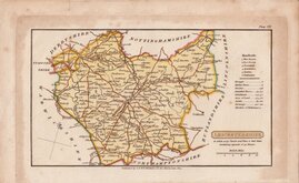
Henry Cooper 1808 [1825]
George Cole 1810 [1843]
Samuel John Neele 1818 [1819]
Sidney Hall 1820
John Cary 1822
Roger Creighton 1831 [1844]
Joshua Archer 1833
Gray & Son. 1833 [1840]


18x11 cm
ALSO KNOWN AS "WHITTAKER" OR "CAPPER" MAPS
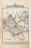
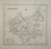
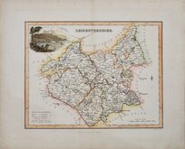
LEICESTERSHIRE
Published by G & W.B.Whitaker, 13, Ave Maria Lane 1824.
Drawn and engraved by Henry Cooper, published by Richard Phillips in Benjamin Capper's Topographical Dictionary in 1808 and later issues of the same work by various publishers until 1839.
Henry Cooper (fl.1808-1819), was born about 1782, the son of Henry Cooper, a lighterman of Beer Lane, Tower Street, London. He was apprenticed to engraver John Warner (fl.1776-1811) from May 1787 and free Oct 1804. He was in partnership for a short time with hydrographer John Purdy (1773-1843) as map and chart sellers on Ludgate Hill, the partnership was dissolved Nov 1811 and bankruptcy proceedings commenced March 1812.
Some perimeter staining but the map is relatively clean in line & wash hand colour. With the imprint of G & W.B. Whittaker published from 1825.
Quick Links


Staffordshire Maps

Warwickshire Maps
×