
Staffordshire Maps
Leicestershire Maps
( Page 1 of 3 )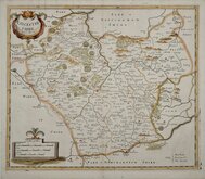
Robert Morden 1695 [1753]
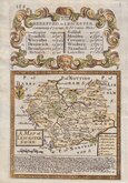
Emanuel Bowen 1720
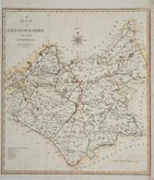
Joseph Ellis 1765 [1773]
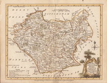
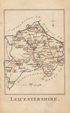
John Haywood 1787 [1791]
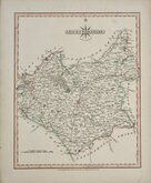
John Cary 1787 [1793]
John Cary 1789 [1805]
Robert Butters 1803
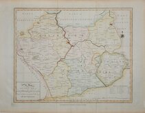
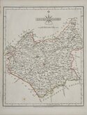
John Cary 1808 [1809]


10x15 cm
CARY'S MINIATURE SERIES.
LEICESTERSHIRE
London. Published by G.&J.Cary, No.86 St. James's Str.
A re-engraved and revised version of of the map issued by John Cary in 1806 which in turn, was a re-engraved version of his 1789 map. All were issued under the title of Cary's Traveller's Companion, a highly successful work necessitating the re-engraving of worn plates to continue publication. The map was later published by Crutchley in his Railroad Companion of 1862 printed by lithographic transfer.
Fingermarking to margins. Original hand colour. From the first state of the re-engraved plate published 1822-28.
Quick Links


Northamptonshire Maps

Warwickshire Maps
×