
Northamptonshire Maps
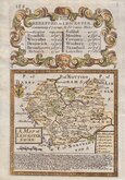
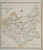
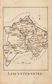
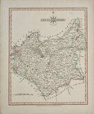
Leicestershire Maps
( Page 1 of 3 )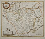
Robert Morden 1695 [1753]
Emanuel Bowen 1720
Joseph Ellis 1765 [1773]
John Haywood 1787 [1791]
John Cary 1787 [1793]
John Cary 1789 [1805]
Robert Butters 1803
John Cary 1808 [1809]


25x24 cm
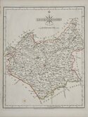
ORIGINAL HAND COLOUR DEPICTING THE POOR LAW UNIONS.
LEICESTERSHIRE.
Drawn by R.Creighton | Engraved by J.& C.Walker
DRAWN AND ENGRAVED FOR LEWIS’ TOPOGRAPHICAL DICTIONARY.
Copper engraving by J & C Walker from a drawing by Roger Creighton published in A Topographical dictionary of England…Samuel Lewis and Co. from 1831. The work achieved considerable success and was re-issued many times by Lewis until 1849. During this time the maps were amended and updated to include electoral information and the rapidly expanding railway network.
This map of Leicestershire has the addition of the Poor Law Unions dating it at the 1844 publication.
Original outline hand colour. Vertical fold as issued.
Quick Links


Staffordshire Maps

Warwickshire Maps
×