
Northamptonshire Maps
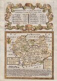
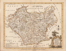
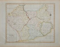
Leicestershire Maps
( Page 1 of 3 )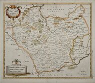
Robert Morden 1695 [1753]
Emanuel Bowen 1720
Joseph Ellis 1765 [1773]
John Haywood 1787 [1791]
John Cary 1787 [1793]
John Cary 1789 [1805]
Robert Butters 1803
John Cary 1808 [1809]


25x20 cm
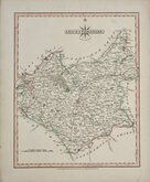
UNCOMMON. BASED ON CARY'S QUARTO SERIES.
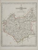
LEICESTER.
Neele Sculpt. Strand.
Published by J. Robins & Co. Albion Press, London January 1st. 1818.
Drawn and engraved by Samuel John Neele, this series were based on John Cary's 'quarto' maps of 1793. The early publication of this series is complex with loose issues and parts issues for many counties from about 1812. The first publication containing the complete set of county maps was The New British Traveller; or, modern panorama of England and Wales...By James Dugdale... published about 1818 by J & J Cundee. The map appeared in only three further issues under different titles in 1819 and 1820.
Samuel John Neele (1758-1824) was a prolific engraver working from Russell Court from 1781 and 352 Strand from 1785-1824. He traded with his younger brother George Neele as “S.& G. Neele” 1826-1824 and with his son James Neele as “Neele & Son” 1816-1824.
This example of the map of Leicestershire has the imprint of J.Robins dated 1818 and was published by J.Robins & Co.from 1819 to 1820. Small margins bottom and right with partial loss to imprint bottom border.
Quick Links


Warwickshire Maps

Staffordshire Maps
×